The following is the trip report I wrote for my club's publication Uprope:
Wyoming’s Wind River Range and Gannet Peak,
Something “Special”
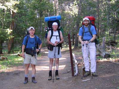
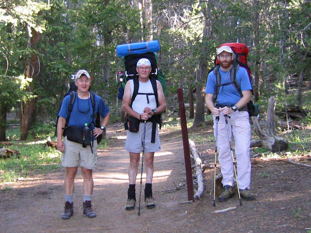
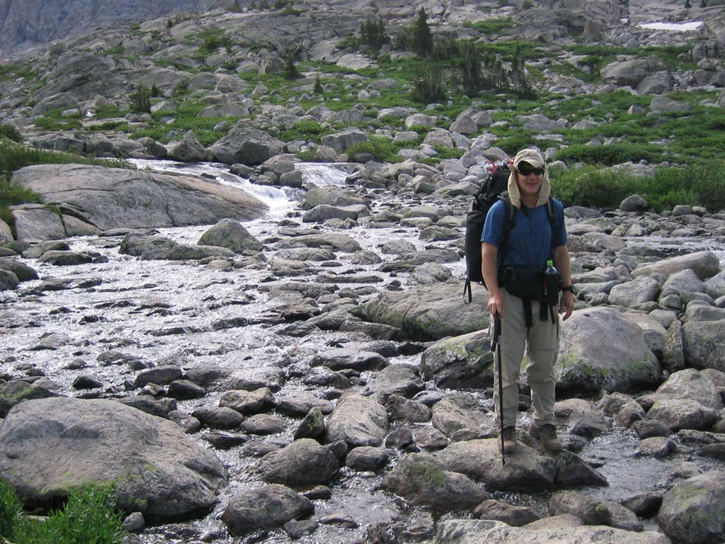
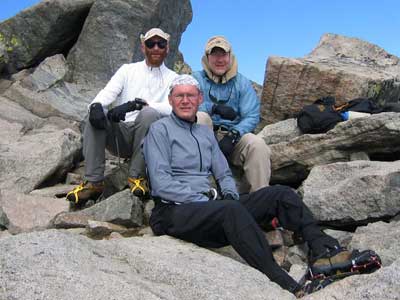
The last day of July 2004 Dave Green, John Smith, and I met in a Pinedale, Wyoming for a very memorable week. Sunday, August 1st at the trailhead at Elkhart Park at a quarter to 9, we hefted our packs and started walking; the day’s destination: Little Seneca Lake. First stop was the very aptly named “Photographer’s Point.”
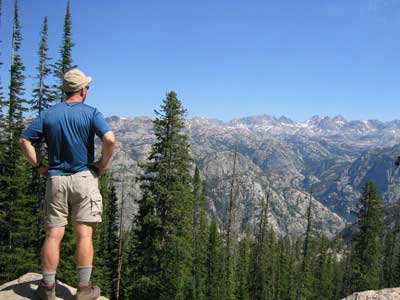
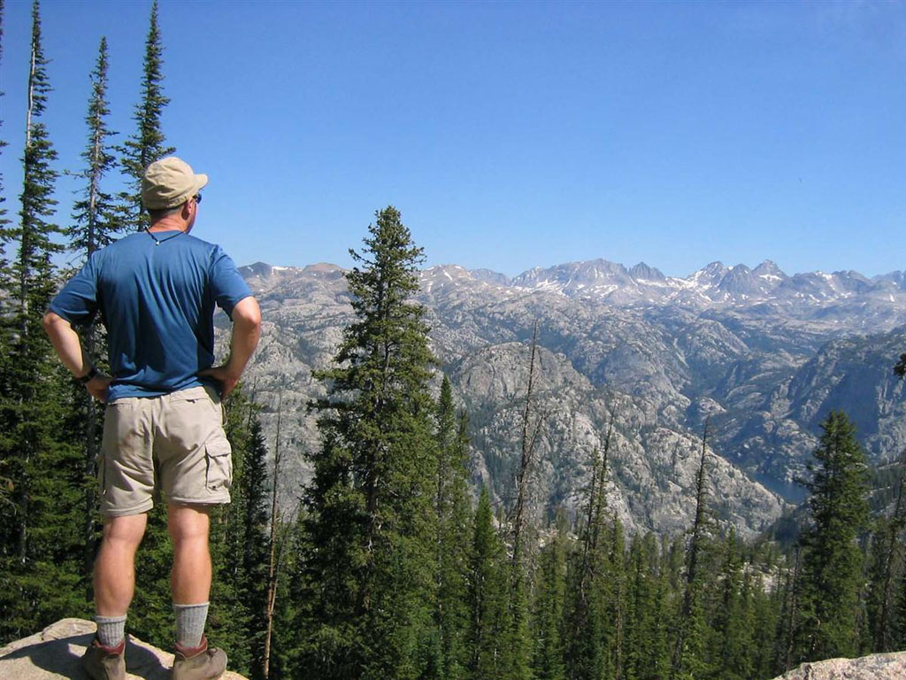
Needless to say had we gone no further the price of the airfare may have been justified. Before us lay a vast panorama of jagged peaks with our ultimate destination (Titcomb Basin and Gannet Peak) lost in the expanse. The severity of our task began to sink in with a sense of awe mixed with humility. Enter modern technology (GPS) and good, basic navigation (map and compass) and a speck of white among the peaks revealed itself as the summit ridge of our final goal, Gannet Peak some 12 miles distant. We shouldered our loads and continued our trek along the well-worn trail crossing beautiful streams and lakes reflecting the ever-present images of distant but nearing peaks. In mid afternoon a short rain welcomed us to our camp past Little Seneca Lake. It was soon replaced by our annoying companions for much of the rest of the trip – mosquitoes.


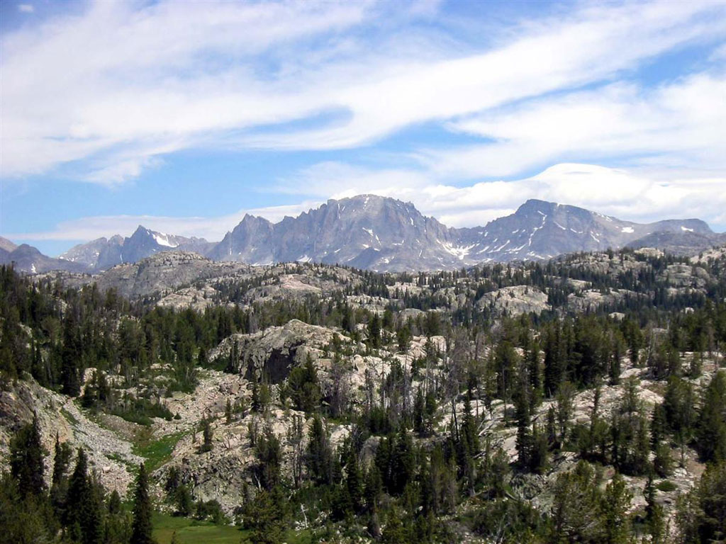
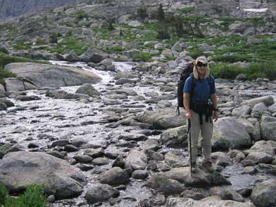
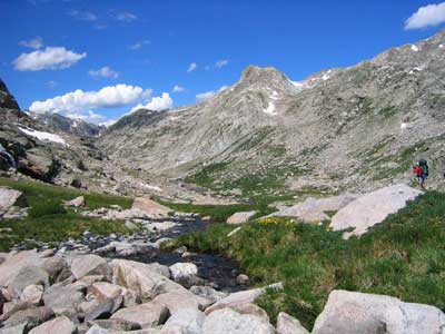
The scenery the second morning was a continuation of the previous day’s beauty but took on a more alpine feel as we neared the entry to Titcomb Basin. Peaks loomed higher and closer with the mass of Freemont Peak dominating the view. As we came alongside the first of the Titcomb Lakes the air carried the chill off the glaciers ahead. Soon the first real obstacle in route to Gannet appeared in the snows of 12,800-foot high Bonney Pass. Surrounded by steep walls we made camp beyond the Upper Titcomb Lake near the convergence of the streams of melt water from Bonney pass and Knapsack Col. A heavy rain passed in the night with us snug and safe inside our shelters. A bit of excitement came as the torrents undercut rock high up one of the peaks; the noise of the crashing boulders continued for several tense seconds.
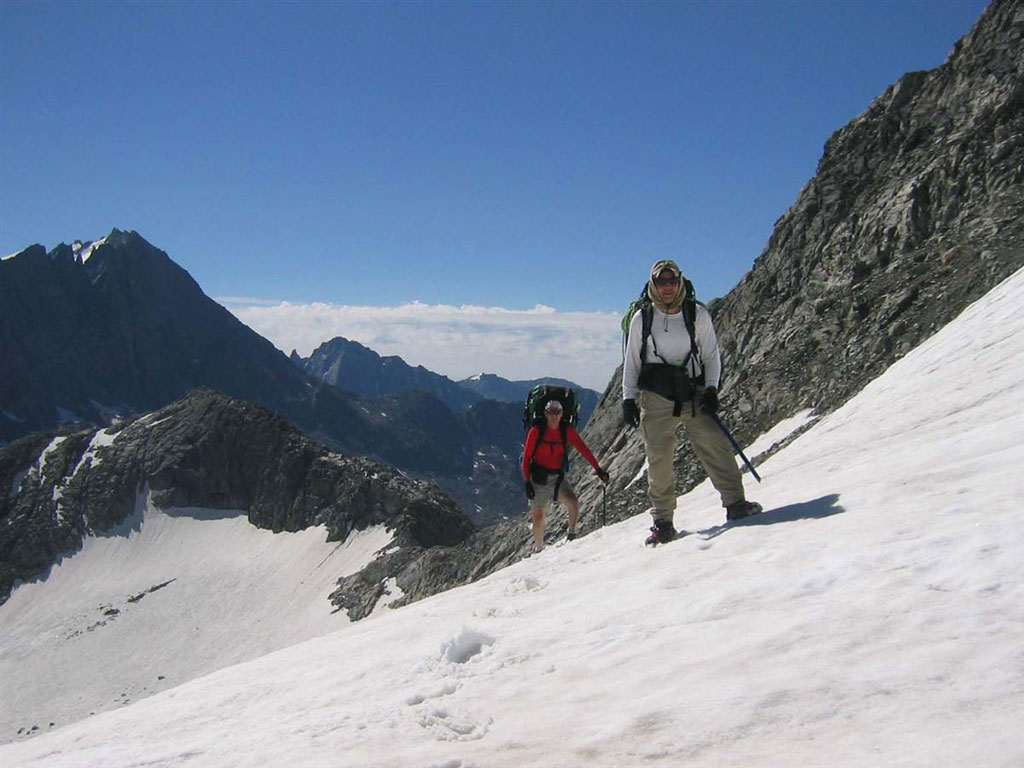
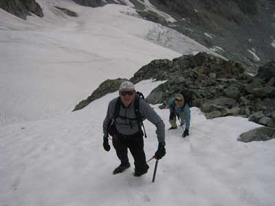
Day 3 began not long after first light with drying gear from the night’s rain. Our plan was to keep a camp here and carry light packs of just bivy gear for the next day’s climb of Gannet. Thus unencumbered we climbed the surprisingly steep snow (up to 50 degrees) to Bonney Pass where we met a pair from Alaska with their glacier pups – a pair of chocolate labs named Satchel and Gaylou. Camped on the pass for days, they were thoroughly fit and acclimated. Those dogs were really a sight to see running about the snow slopes and playing out across the glacier.
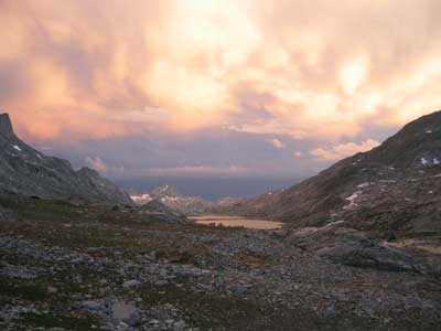
From the pass we cast eyes on our route up Gannet for the first time and it showed us no apparent difficulties. We dropped down onto the Dinwoody Glacier, which proved tame except for a broken section just before Gooseneck Ridge. This was negotiated by way of delicate snow bridges and soon our bivy was established at 12,000 feet on the ridge, almost at the base of the route. The afternoon precipitation welcomed us as graupel at that elevation so without tents, we sought refuge amongst the rocks as best we could. It passed quickly though and clear skies surrounded us the rest of the evening.
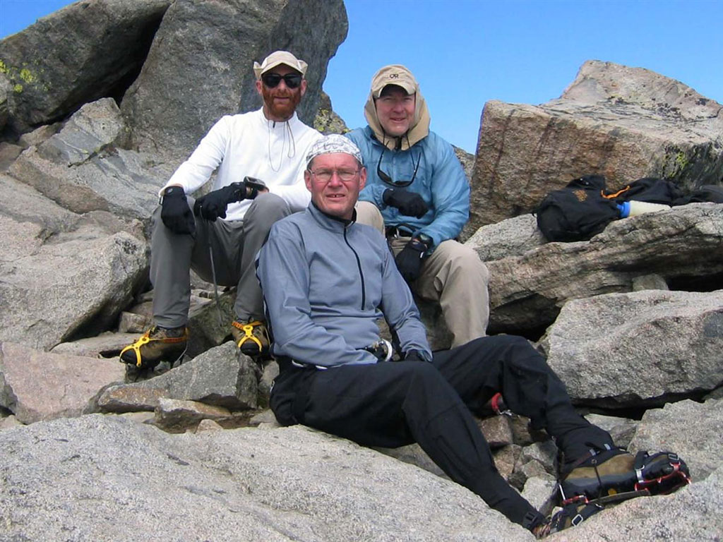
Wednesday August 4 began as one of the most leisurely summit days I’ve had. Mr. Sun was already touching the peaks around us as we crawled from our sacks and began the day. A peek at my watch showed the inordinately late hour of 7am as we began to head up. A 30-degree slope above camp took us up a few hundred feet to a boulder scramble across right to a steeper snowfield. Increasing to 45 degrees and narrowing to 30 feet it lead up beside the most prominent feature of the route, Gooseneck Pinnacle. Here we unshod crampons for a consistently rising boulder scramble that put us ¼ mile closer to the top. This ended at a 40-degree slope that we climbed directly to the summit ridge 300 feet above. From there a simple traverse following a deep boot track lead the final half-mile to the summit. It was not without exhilaration; the precipitous 1000-foot drop of the West face was to our left and the slopes to the right fell away at a frightening angle. The summit was a pleasant one with plenty of space to relax after our unhurried 9:30 arrival.
The view from Wyoming’s roof was magnificent with peaks and glaciers in every direction, alpine lakes far below, and the somewhat less than Grand Tetons visible faraway to the Northwest. After recharging ourselves and recording the effort photographically and in the summit log, we began the uneventful trip down.
Back on the Dinwoody we encountered thunderous streams of melt water disappearing into dark wells on the glacier. That unearthly environment never ceases to amaze me. Much later, nearing camp in Titcomb Basin we were greeted by a trio of backpackers with way too much dessert. These gluttons had packed everything but the kitchen sink (at least we didn’t see it) but, to their credit, they could really cook! A fitting conclusion to a successful day.
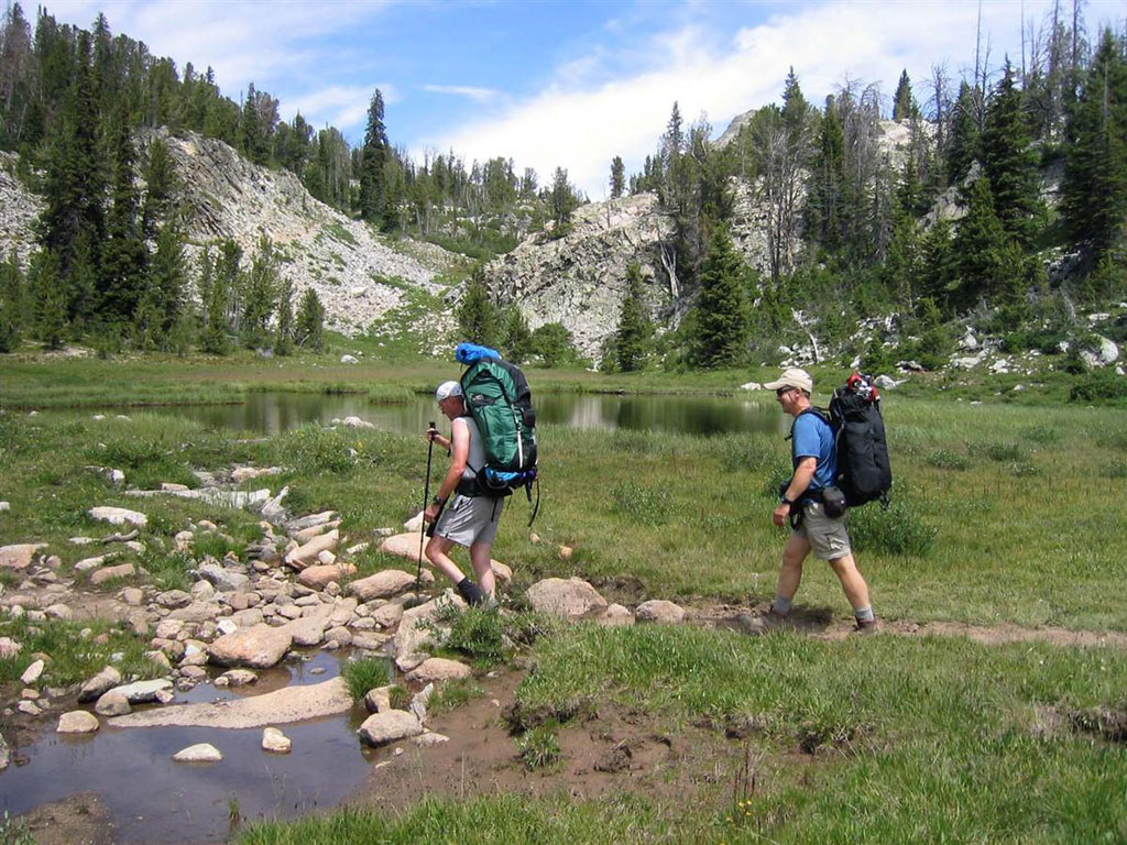
Often the day after a successful summit is a restful “letdown” but Thursday was anything but that. We arose well after the sun but wasted no time breaking camp and reorganizing and loading for the planned three-day hike out. We retraced our steps up the valley but shortly headed left over the deep sun cups of Twins Glacier and up to 12,250 foot high Knapsack Col.

We paused for a short break in the col and gazed at a small yellow flower there – the sole source of color amid a mass of grey rock. The sky was generally clear and the temperature agreeable as we descended the other side over steep, loose scree to the lush grasses of an alpine valley the likes of which is hard to match.
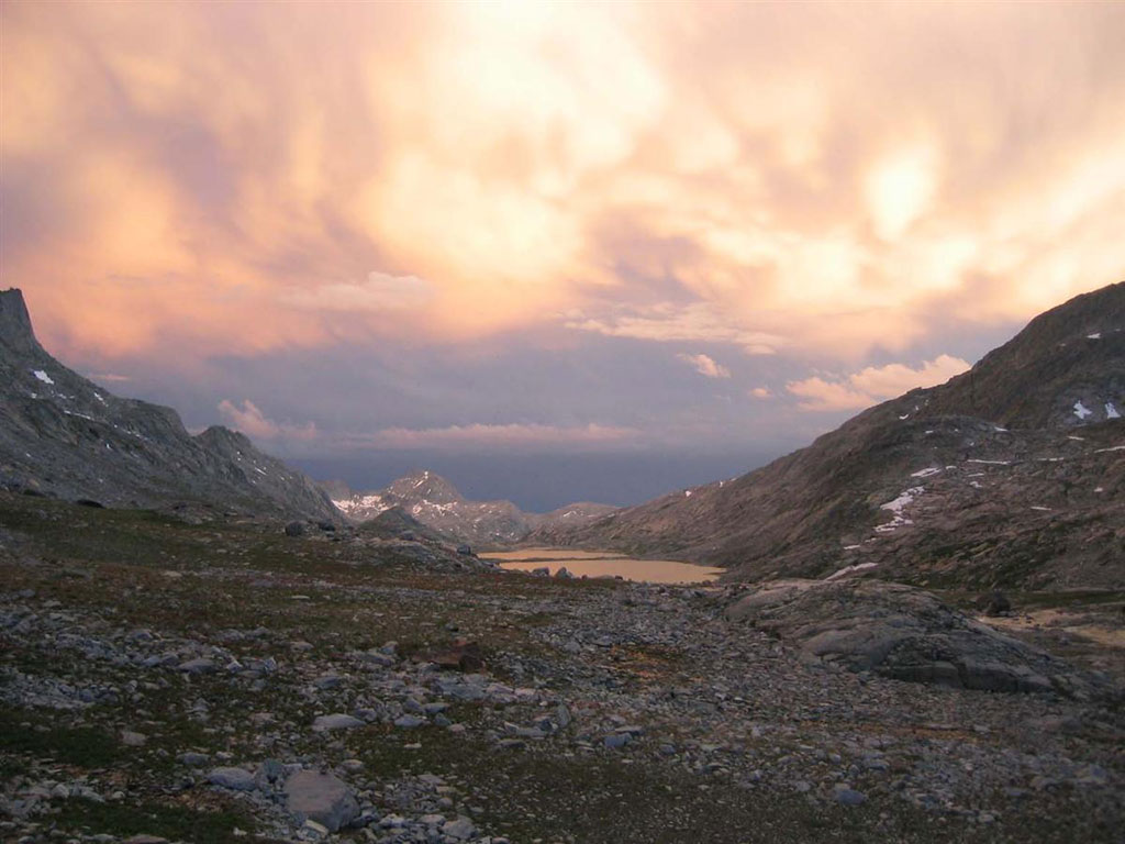
We stopped in a meadow full of wildflowers next to a raucous stream with a huge waterfall nearby. We were still high with not a tree in sight, which helped to serve up an unobstructed view. I marked this spot in my GPS simply “777”. Continuing on we passed Peak Lake as the sky darkened for the afternoon shower. Shannon Pass was our next obstacle – one which the backpackers in Titcomb Basin warned us not to try the same day as Knapsack Col. We considered this a worthy dare and after a short pause continued on up. Shannon pass is not high but stretches for about a level mile alongside precipitous Stroud Peak with Mount Oeneis and Sky Pilot Peak off to the right. Down near the junction with the Jeanne Lakes trail we made camp. While Dave set up his shelter John and I hiked up a nearby peak to gaze at the landscape and our route for the next day. The map showed no name for this high point so we dubbed it PATC PEAK.
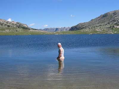
Friday we continued on a fairly level grade around Elbow Lake and past Twin Lakes and Pass Lake. Several miles later a really pleasant surprise greeted us. A little sand beach along the South side of Summit Lake invited us into the clear water. At 10,324 feet the water is liquid only a few months of the year but after six days without a shower we couldn’t pass on it.
Thoroughly invigorated we continued to the Pine Creek Canyon Trail, which would ultimately take us back to the cars. The rest of that day was filled with a continuation of what was quickly becoming blandly beautiful scenery. By late afternoon we had covered about 12 miles and found ourselves at Glimpse Lake. Our camp there was probably the most comfortable for the trip – we dubbed it the Glimpse Lake Hilton.
Saturday reaped the benefit of Friday’s longer mileage. The distance to Elkhart Park was comparatively short but demanded a 1500-foot drop to Long Lake then back up another 1600. Easy, if it’s a day trip, but when one considers the weariness of 7 days on the trail, days spent almost entirely above 10,000 feet, ease becomes a feat.
Back in town, with bodies washed and bellies satisfyingly full, thoughts returned to the week’s unparalleled beauty. We each agreed: the Winds is a “Special” place.